
Revision summary
India’s coast and EEZ hold fish, ports, offshore energy, beach minerals, salt, and tourism. Cyclones, the 2004 tsunami, surge, and erosion are the main natural hazards. The Disaster Management Act, 2005, IMD, INCOIS, and cyclone shelters have lowered death counts. CRZ rules and mangrove buffers are unevenly enforced. Ports and fishers need the same map of hazard before the next surge.
Model answer
Copper italics in this answer — like this — are the key facts. Each one is unpacked in the Facts & figures rail.
Introduction
India’s coast, about 7,500 kilometres including the islands, is a blue-economy asset of fish, ports, oil, salt, and tourism. The same belt faces cyclones, storm surge, tsunami, erosion, and sea-level rise, so resource talk is incomplete without hazard preparedness.
Body
Resource potentials
- The Exclusive Economic Zone, over two million square kilometres, holds marine fish, seaweed, and possible hydrocarbons beyond the older Bombay High and Krishna–Godavari fields.
- Thirteen major ports and a long chain of non-major ports, tied to Sagarmala, move bulk cargo, containers, and coastal shipping that can cut road freight.
- Beach and dune minerals such as ilmenite, rutile, and garnet in Kerala, Tamil Nadu, and Odisha, plus salt in Gujarat, are industrial inputs.
- Estuaries and mangroves of the Sundarbans, Bhitarkanika, and the Gujarat gulf support breeding fish, carbon, and storm buffers.
- Coastal tourism from Goa to Puri and the Andaman and Lakshadweep islands is a large service resource if waste and coral damage are controlled.
- Tidal, wave, and offshore wind potential exists on western and southern shelves, though commercial scale is still early.
Natural hazards on this coast
- Bay of Bengal cyclones hit Odisha, Andhra Pradesh, Tamil Nadu, and West Bengal with wind, rain, and storm surge; the Arabian Sea has also grown more active in recent decades.
- The 2004 Indian Ocean tsunami showed that the Andaman–Nicobar and Tamil Nadu coasts sit on a real tsunami path.
- Erosion, saline intrusion, urban flooding, and oil spills are slower hazards that still destroy livelihood.
Status of preparedness
- The Disaster Management Act, 2005, NDMA guidelines, and state disaster authorities give a legal frame that did not exist in the 1999 Odisha super cyclone years.
- IMD cyclone warnings, INCOIS tsunami bulletins, and coastal sirens and shelters have cut death tolls, as the contrast between 1999 Odisha and later cyclones such as Phailin (2013) and Fani (2019) shows.
- The Coast Guard, Navy, and NDMA–NDRF drills help ships and plants, but fishing villages still lose boats and days at sea.
- CRZ Notification, 2019, tries to zone hazard and ecology, yet enforcement is uneven against illegal reclamation and hotel creep.
- Insurance, mangrove restoration, and last-mile warning in local languages remain weaker than satellite forecasts.
Way forward
- Treat mangroves and dunes as infrastructure, not as spare land for ports.
- Complete cyclone shelters, all-weather houses under coastal PMAY-U and state schemes, and boat-to-phone warning for small fishers.
- Align Sagarmala and coastal power plants with NDMA flood and surge maps before construction.
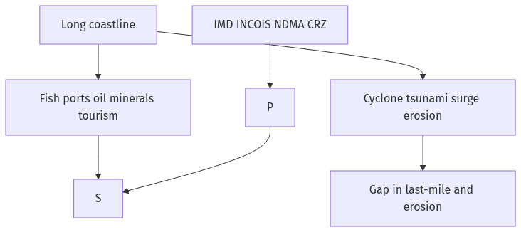
Flow diagram
Conclusion
The long coast can feed fisheries, ports, minerals, and tourism if the EEZ is used with care. Preparedness has improved in cyclone warning and law since 2005, but erosion, surge, and weak local enforcement still leave fishers and slums exposed.
Quick related
Students also ask
-
Discuss the natural resource potentials of 'Deccan trap'
Next question on this syllabus topic (2022 · Q6). View answer →
-
Has cyclone preparedness actually improved?
Deaths have fallen with warnings and shelters compared with 1999 Odisha. Livelihood and house loss remain high.
-
Is Sagarmala in conflict with hazard safety?
It can be if ports ignore surge and mangrove maps. It need not be if those maps bind the project.
Same topic · past papers
UPSC has asked this before
These previous-year questions sit on the same topic. Open one to practise the earlier ask.
-
2022 · Q6 · GS I · 10 marks
Discuss the natural resource potentials of 'Deccan trap'
More from this topic
Q7 · UPSC Mains 2026 · GS I · 10 marks · Solution
"Water resources are both an asset and a source of conflict in South Asia." Examine this statement giving examples.
Natural Resources and Industries
• South Asian river systems drive regional economies through massive agricultural irrigation and vital hydropower generation. • Rapid population growth and climate change have increasingly turned these shared lifelines into geopolitical flashpoints. • India-Pakistan water friction persists through disputes over run-of-the-river hydroelectric projects under the Indus Waters Treaty. • Unresolved bilateral deadlocks, such as the Teesta river sharing impasse, highlight complex domestic political challenges. • Upstream Chinese dam construction on the Brahmaputra creates severe ecological and strategic anxiety for downstream nations. • Effective regional stability requires moving away from zero-sum basin nationalism toward cooperative hydro-diplomacy. • Institutional frameworks must treat shared river basins as common ecological trusts to ensure sustainable regional development.
Q14 · UPSC Mains 2025 · GS I · 15 marks · Solution
Give a geographical explanation of the distribution of off-shore oil reserves of the world. How are they different from the on-shore occurrences of oil reserves?
Natural Resources and Industries
Offshore oil lies in sedimentary traps on continental shelves and slopes. Major provinces include the Persian Gulf, North Sea, Gulf of Mexico, West Africa, Brazil's pre-salt, and India's Mumbai High and KG basin. The geology is kin to onshore basins; the difference is water depth, platforms and spill behaviour. Onshore fields are usually cheaper to develop and easier for a state to hold physically. Disputed seas turn offshore oil into a geopolitical resource, not only a geological one. Deep water is capital-heavy, so price slumps hit it first.
Q5 · UPSC Mains 2023 · GS I · 10 marks · Solution
Why is the world today confronted with a crisis of availability of and access to freshwater resources?
Natural Resources and Industries
Usable freshwater is a small and uneven share of global water. Farms, falling groundwater, climate shifts, and pollution cut availability. Poverty, tanker markets, and transboundary politics cut access. Virtual water in trade moves scarcity from one region to another. SDG 6 will fail unless drinking rights, irrigation reform, and clean rivers are treated as one task.