
Revision summary
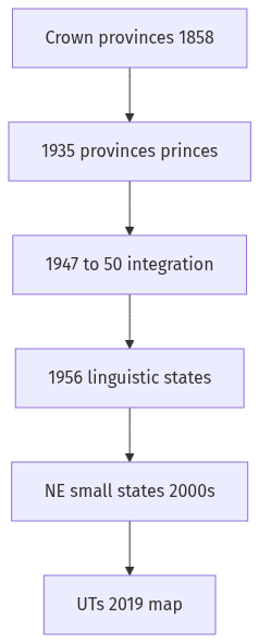
Crown rule after 1858 carved and merged provinces, including the Bengal partition of 1905. Independence integrated princely states, then the 1956 Act made language the main state principle. Bombay 1960, Punjab 1966, and north-eastern states showed the map was still moving. 2000’s three states and Telangana 2014 split units inside older language regions. Union Territories, including the 2019 J&K change, keep reorganisation alive.
Model answer
Copper italics in this answer — like this — are the key facts. Each one is unpacked in the Facts & figures rail.
Introduction
From the 1850s the map of Indian government has been redrawn as conquest, Crown rule, language, tribe, and administrative convenience demanded. Reorganisation is therefore a habit of the modern Indian state, not a one-time act of 1956.
Body
Crown and late-colonial map
- After 1858 the Crown inherited Company presidencies and then carved Chief Commissioner’s provinces, as in the Central Provinces, to tighten civil and forest control.
- The 1905 partition of Bengal, reversed in 1911, showed that administrative convenience and communal arithmetic could split a cultural region and then be forced back.
- The Government of India Act, 1935, enlarged provincial autonomy and separated Burma (1937), which was an imperial reorganisation of the Indian Empire’s outer ring.
- Princely states remained a parallel map until 1947, so political India was already two kinds of territory before Independence.
Integration and the linguistic settlement
- 1947–49 integration of princely states, and the 1950 Constitution’s Parts A, B, C, and D, turned a patchwork into a Union that still needed a rational map.
- Andhra (1953) after Potti Sriramulu’s fast, and the States Reorganisation Act, 1956, made language the main provincial principle, with Bombay and Punjab still unsettled.
- Bombay split into Maharashtra and Gujarat in 1960; Punjab, Haryana, and a Union Territory of Chandigarh followed in 1966, showing that 1956 was a station, not a terminus.
- Himachal Pradesh moved from Union Territory to state (1971), which is the same logic of upgrading administration as people and roads thickened.
North-east, small states, and later cuts
- Nagaland (1963), and the North-Eastern Areas Reorganisation of 1971–72 that produced Meghalaya, Manipur, and Tripura as states, answered hill politics that language commissions had not settled.
- Sikkim’s 1975 accession as a state added a Himalayan case of reorganisation by referendum and constitutional amendment.
- Chhattisgarh, Uttarakhand, and Jharkhand in 2000 split large Hindi-belt and tribal-industrial units for governance and identity.
- Telangana in 2014 divided Andhra Pradesh on a regional-development claim inside one language, proving that linguistic unity does not freeze internal maps.
- Jammu and Kashmir’s 2019 reorganisation into Union Territories changed a state into federally administered units, the latest sharp example of ongoing territorial politics.
Union Territories and the city
- Delhi, Puducherry, the Andaman and Nicobar Islands, Lakshadweep, Chandigarh, Dadra and Nagar Haveli and Daman and Diu, Ladakh, and Jammu and Kashmir show that the Union still uses UTs where capital, colonial leftover, island, or security logic outweighs full statehood.
- The process continues whenever a hill, a city, or a linguistic minority finds the existing unit too large or too hostile.
Flow diagram
Conclusion
Since the mid-nineteenth century India has redrawn provinces for empire, language, tribe, development, and security. 1956 was the largest linguistic settlement, not the last word; examples from Bengal 1905 to Telangana 2014 and the 2019 Union Territories prove continuity.
Quick related
Students also ask
-
Describing the distribution of rubber producing countries, indicate the major environmental issues faced by them.
Next question on this syllabus topic (2022 · Q15). View answer →
-
Did linguistic reorganisation end in 1956?
No. Bombay, Punjab, the north-east, and Telangana all came later.
-
Are Union Territories a colonial leftover only?
Some are. Others, including 2019 units, are contemporary federal choices about security and control.
Same topic · past papers
UPSC has asked this before
These previous-year questions sit on the same topic. Open one to practise the earlier ask.
More from this topic
Q17 · UPSC Mains 2026 · GS I · 15 marks · Solution
Analyze the major drivers of human-induced land-use changes in India and their geographical consequences.
World's Physical Geography
Anthropogenic pressures driven by population growth and economic development are the primary catalysts of rapid land-use and land-cover change (LULCC) across India. Agricultural expansion and intensive multi-cropping, particularly
Q16 · UPSC Mains 2026 · GS I · 15 marks · Solution
"The centre of global trade is gradually shifting from the Atlantic region to the Indo-Pacific region." Examine this statement.
World's Physical Geography
• The global center of economic gravity has decisively shifted from the Euro-Atlantic axis to the Indo-Pacific. • The rise of China, Southeast Asia, and India as primary manufacturing and consumption hubs drives this transition. • Vital maritime chokepoints like the Malacca Strait serve as critical arteries for global energy and merchant trade. • Mega free-trade agreements such as RCEP and IPEF have established new regional trade and rule-making architectures. • Post-pandemic supply chain vulnerabilities have accelerated diversification strategies like 'China-plus-one' and 'friend-shoring'. • Control over critical mineral supply chains powers the ongoing digital and green energy transitions in the region. • Sustaining this geo-economic shift requires robust multilateral frameworks, freedom of navigation, and rules-based maritime governance.
Q14 · UPSC Mains 2026 · GS I · 15 marks · Solution
Compare the Loo, Chinook and Foehn winds with respect to their regions of prevalence, their nature and climatic impacts.
World's Physical Geography
• Local winds like the Loo, Chinook, and Foehn are driven by distinct regional pressure gradients and orographic barriers. • The Loo prevails over the Indo-Gangetic Plain, the Chinook along the Rockies' eastern slopes, and the Foehn across the northern Alpine valleys. • The Loo is a scorching, dust-laden convective surface wind generated by intense summer continental heating. • Both the Chinook and Foehn are warm, dry katabatic winds formed via rapid adiabatic compression on the leeward sides of mountains. • The Loo induces severe agricultural stress, crop wilting, and high health risks like heat strokes in South Asia. • Chinooks act as 'snow eaters' in North America, rapidly melting winter snowpacks and opening up pasturelands for grazing. • Foehn winds accelerate Alpine snowmelt, which simultaneously triggers hazardous avalanches and elevates regional wildfire risks.